Features
Industries
Who we serve
Resources
Sign in
Get Started - $500/month
No commitment. No implementation fee. Unlimited users. Cancel anytime
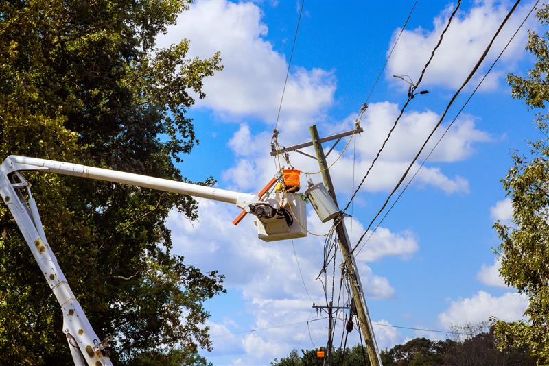
Oncor is the largest electric utility in Texas, delivering reliable power to more than 10 million residents through a vast network of transmission and distribution infrastructure. In spring 2018, a severe storm struck Colorado City, TX, taking down over 20 miles of 345kV transmission lines across challenging, rural terrain.
Faced with extensive damage and difficult site access, one of Oncor’s field services vendor partnered with KYRO and deployed StormShield to enable rapid, safe, and coordinated recovery operations.
The storm’s impact created a complex recovery scenario:
These conditions meant that traditional on-foot inspections and manual coordination would be too slow and too dangerous to meet urgent restoration timelines.
KYRO’s StormShield became the central hub for aerial inspection, crew routing, and safety oversight, enabling Oncor’s vendor to complete a full impact assessment and recovery plan in just 24 hours.
KYRO was integrated for capturing data and geotagged images of damaged transmission spans during aerial inspections. These images were uploaded instantly into the platform, enabling field planners and engineers to review high-risk areas remotely and avoid unnecessary exposure.
As aerial and ground data flowed into KYRO, a live dashboard with a consolidated visual, pinned location data, and status updates were made. This gave restoration teams immediate insights into damage severity, resource needs, and work prioritization, supporting confident, data-driven decisions.
Using KYRO’s maps with color-coded risk zones, contractors identified the most affected areas first and deployed crews accordingly. This ensured equipment and teams reached priority sites quickly, minimizing travel delays in remote ranchlands and single-path ROW zones.
Potential hazards, including energized lines, unstable poles, and roadway crossings, were flagged directly on the digital map. Crews accessed the latest safety intelligence before entering the field, ensuring a proactive, safety-first approach.
Crews used KYRO’s mobile-friendly inspection and daily report forms to log completed tasks, material usage, and work hours on-site. This eliminated paper trails, provided real-time labor cost visibility, and ensured accurate reporting for both contractors and utilities.
From the storm’s initial impact to a fully coordinated recovery plan, the complete damage evaluation process was finished within a single day, dramatically reducing downtime and accelerating restoration efforts.
By pairing aerial data with cutting-edge platform like KYRO’s StormShield, helped Oncor quickly figure out what was damaged, decide what to fix first, and plan the restoration safely. Crews knew exactly where to go and what to expect, avoiding risky guesswork.
This smart approach kept everyone safer, sped up the work, and got Colorado City’s lights back on faster than anyone expected.

This blog was written by Team KYRO, bringing together the expertise of KYRO’s product, engineering, and industry teams. Our content is shaped by hands-on experience, offering practical insights grounded in real operational challenges.
.jpeg)
.png)
.png)