KYRO allows vegetation management teams to capture accurate data, prioritize high-risk areas, and execute projects seamlessly, even in offline environments.


At every stage of the vegetation management process, KYRO provides forms with photo uploads that give the whole team detailed information on the current status of growth and work required to be done.
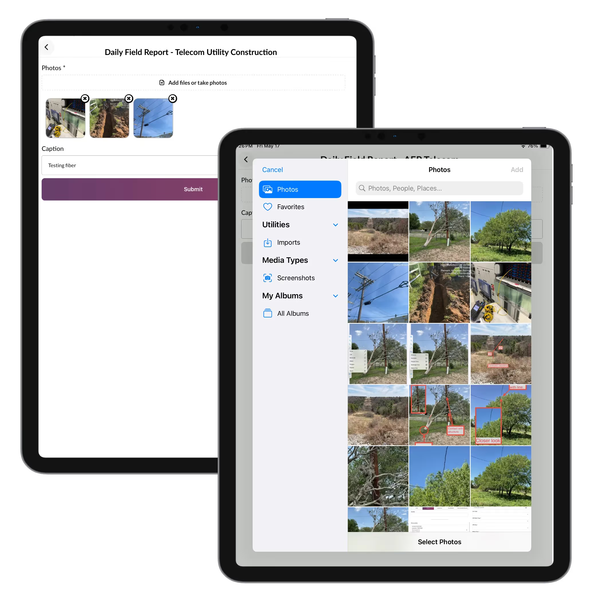

Highlight high-danger zones on aerial view documents and forms, ensuring the entire team is aware of potential hazards. Prioritize tasks and allocate resources where they're needed most, maximizing safety and efficiency.
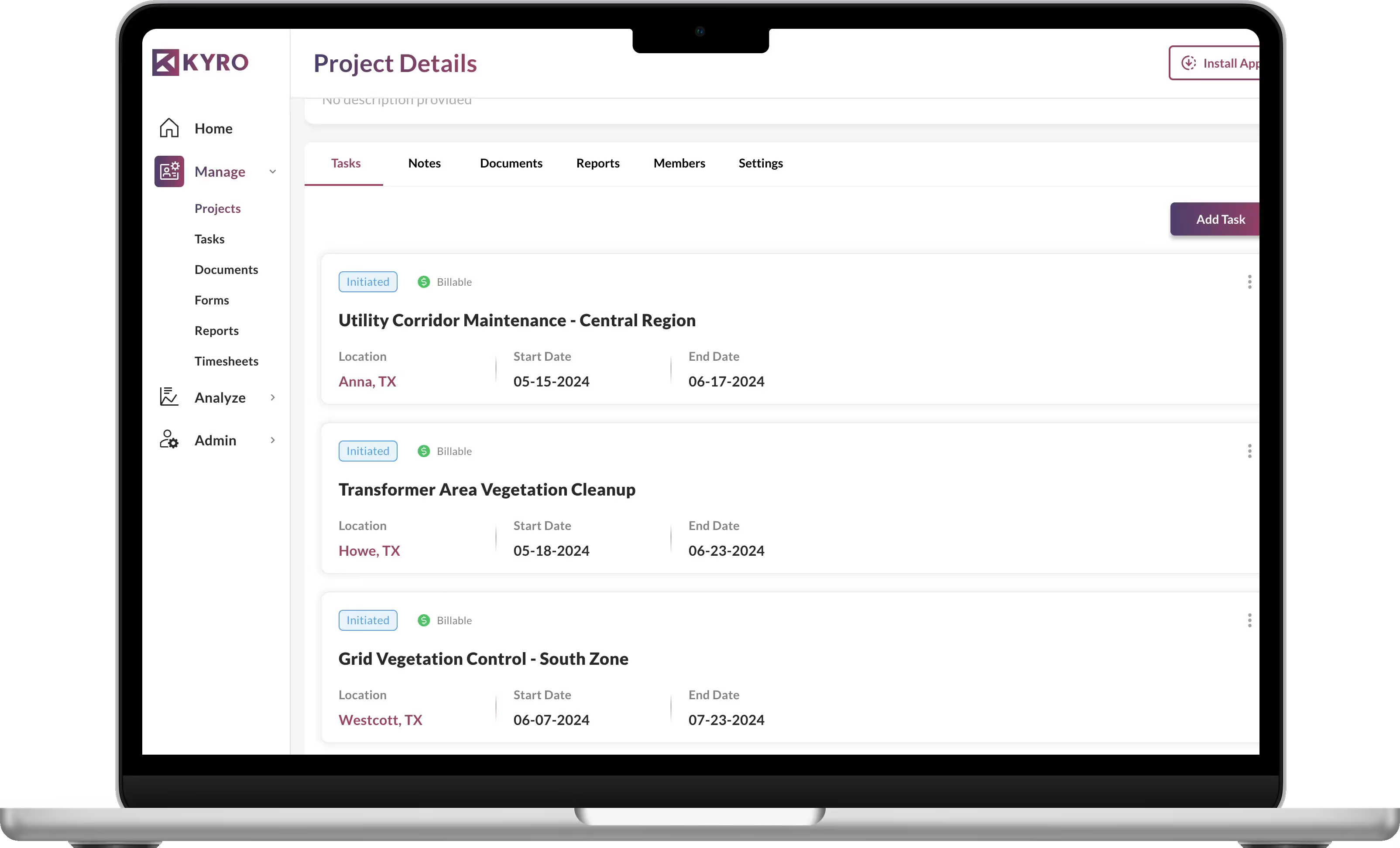
Effortlessly create projects, assign tasks, and manage priorities based on severity. Ensure optimal execution and timely completion of vegetation management activities with KYRO’s simple project management.
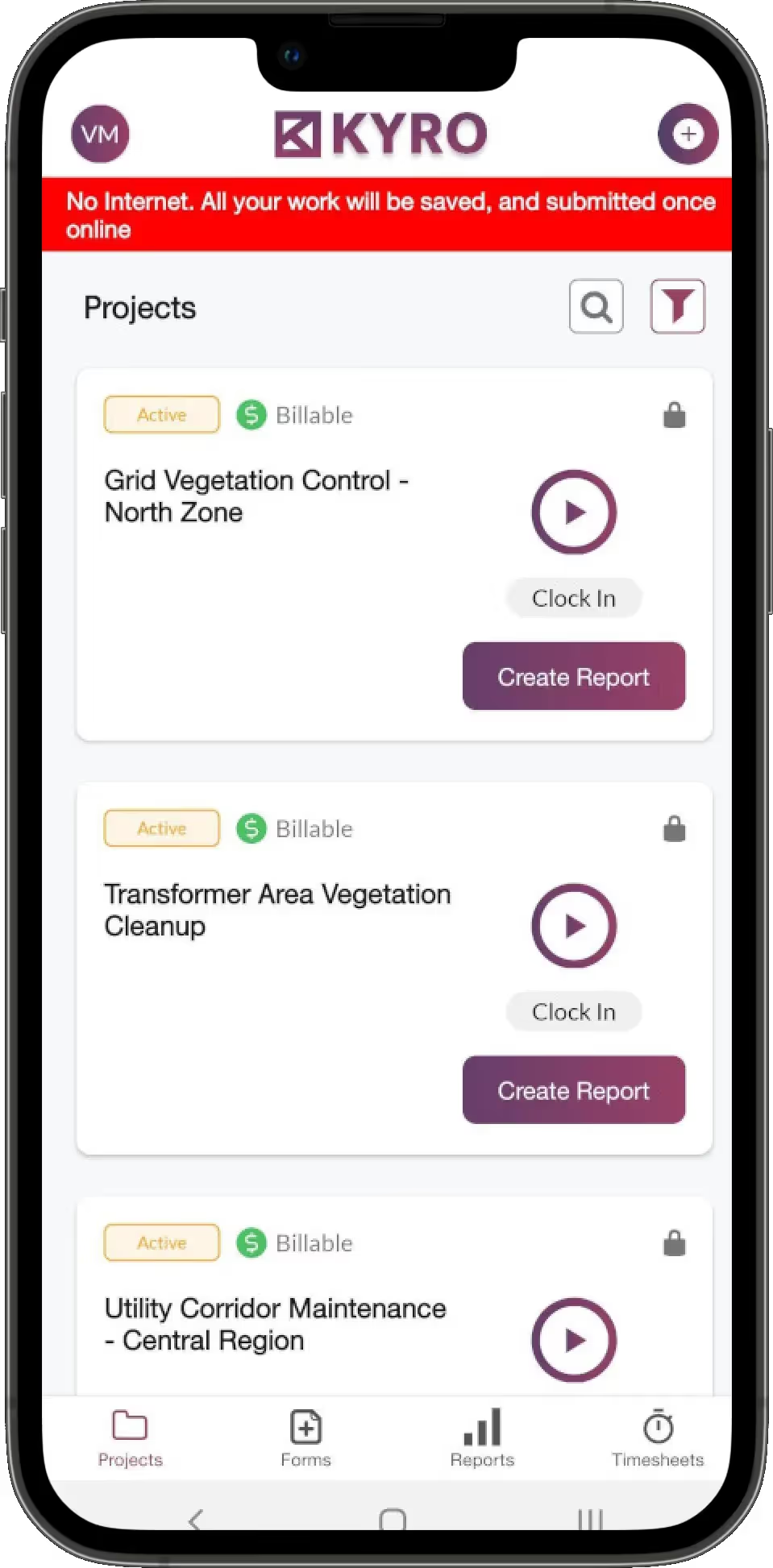
Even in areas of no internet connection, users can capture key information in forms and photos. This will be securely saved and sent to key stakeholders once back online.
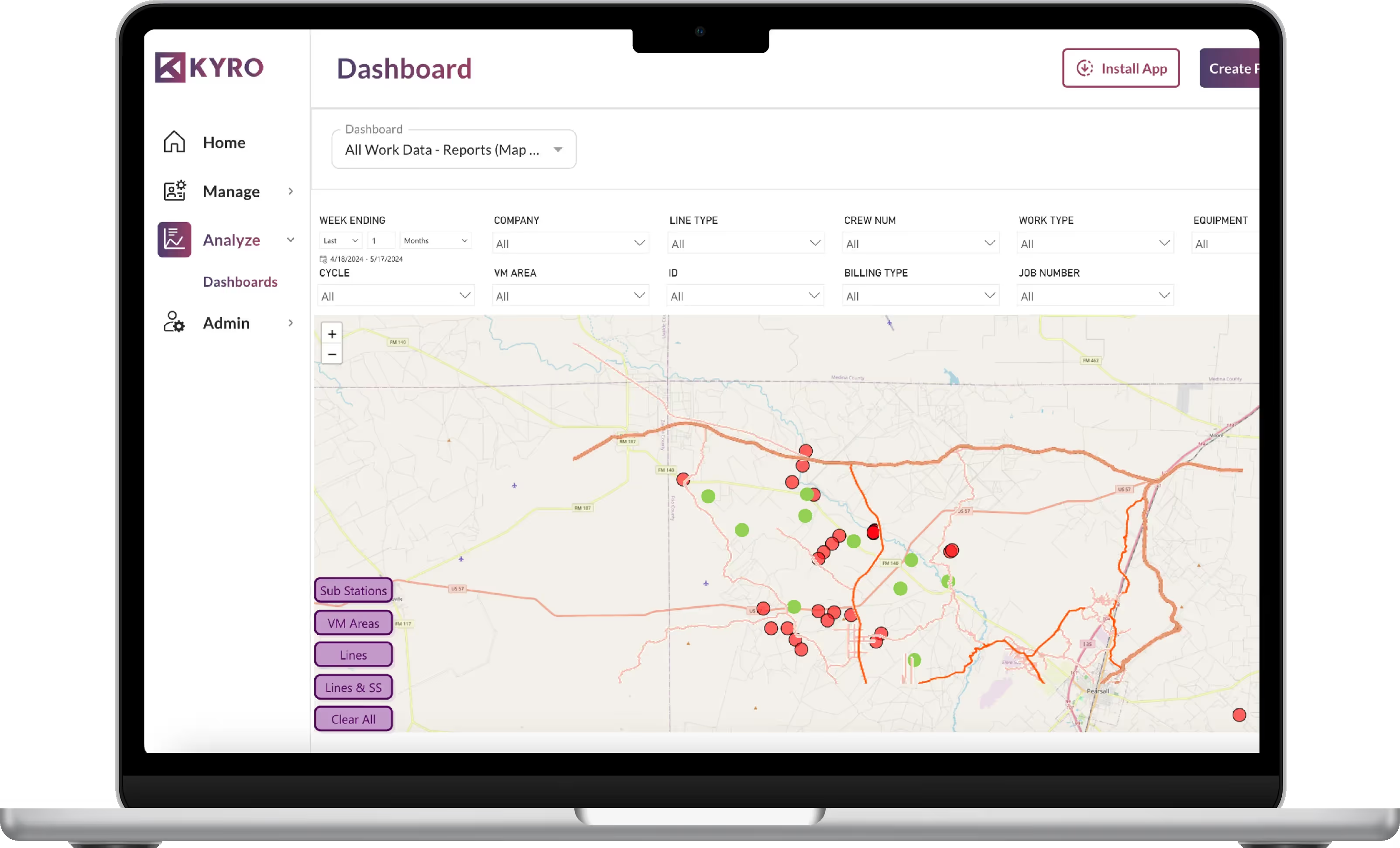
With KYRO's dashboards, get a clear view of where issues have been recorded and take action to get these issues resolved sooner.
Create projects, assign tasks, and prioritize activities based on urgency or severity. KYRO’s project management tools help ensure vegetation management tasks are executed precisely and completed on time.
Access forms with photo upload capabilities at every stage of vegetation management. Ensure your team has accurate, real-time insights into growth status and required work, keeping everyone on the same page.
Monitor encroachments in real-time with dashboard, assess their risk levels, and proactively mitigate potential infrastructure damage to maintain safety and minimize operational disruptions before they escalate into costly issues.
Use redlining and markup tools to clearly highlight danger zones on documents and forms. Focus on high-risk areas, allocate resources effectively, and ensure a safer working environment.
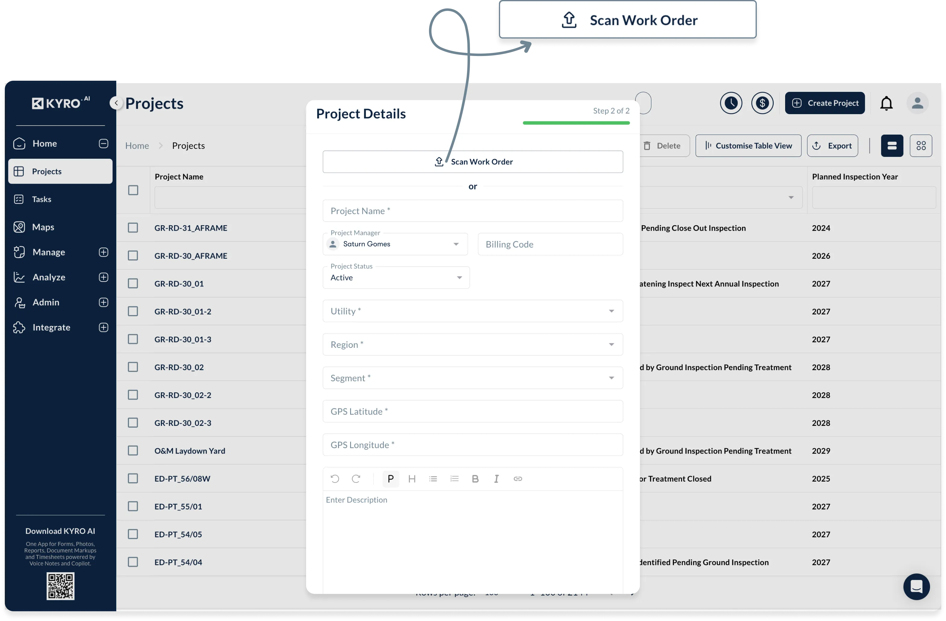
Create projects, assign tasks, and prioritize activities based on urgency or severity. KYRO’s project management tools help ensure vegetation management tasks are executed precisely and completed on time.
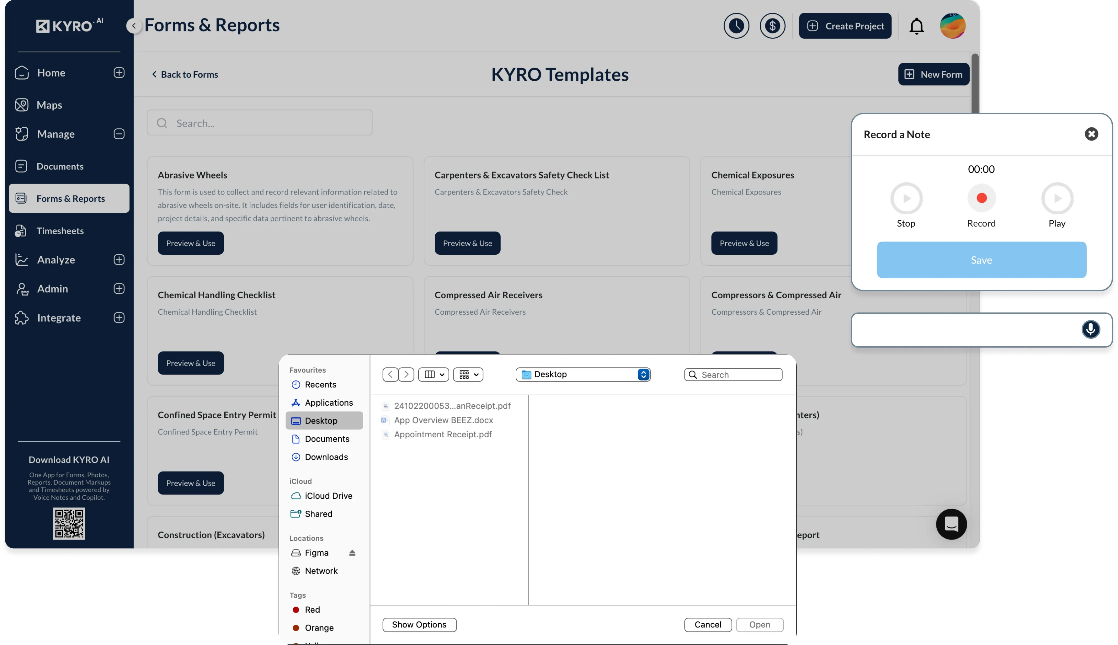
Access forms with photo upload capabilities at every stage of vegetation management. Ensure your team has accurate, real-time insights into growth status and required work, keeping everyone on the same page.
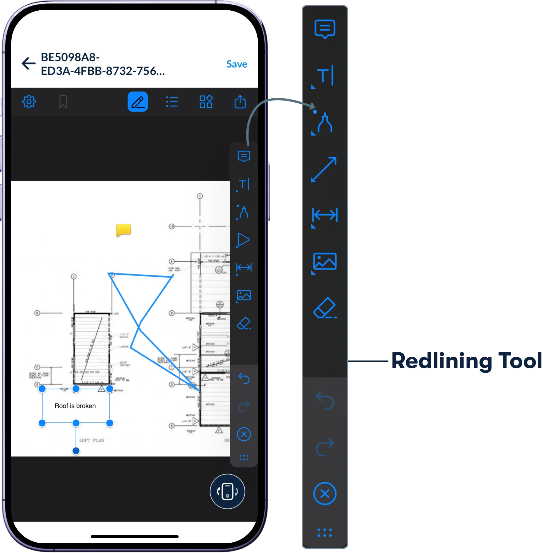
Use redlining and markup tools to clearly highlight danger zones on documents and forms. Focus on high-risk areas, allocate resources effectively, and ensure a safer working environment.
Say goodbye to misplaced forms. Digitally capture every trim order, inspection, photo, and clearance record. Keep everything organized and audit-ready for regulatory reviews, compliance checks, or client reports, saving you time and reducing stress.
Track labor hours, equipment use, and project costs as they happen. Eliminate billing mistakes and streamline payroll, even when managing multiple contractors or service areas, so you stay on budget and on schedule.
Crews in remote areas can log work, snap photos, and update maps without a signal. Once connectivity is back, all data syncs automatically without any loss of details or information.
Get a clear, real-time view of what matters: crew locations, clearance progress, high-risk zones, and vegetation inspection details. Our intuitive live dashboard puts critical insights at your fingertips, so you’re always in control.
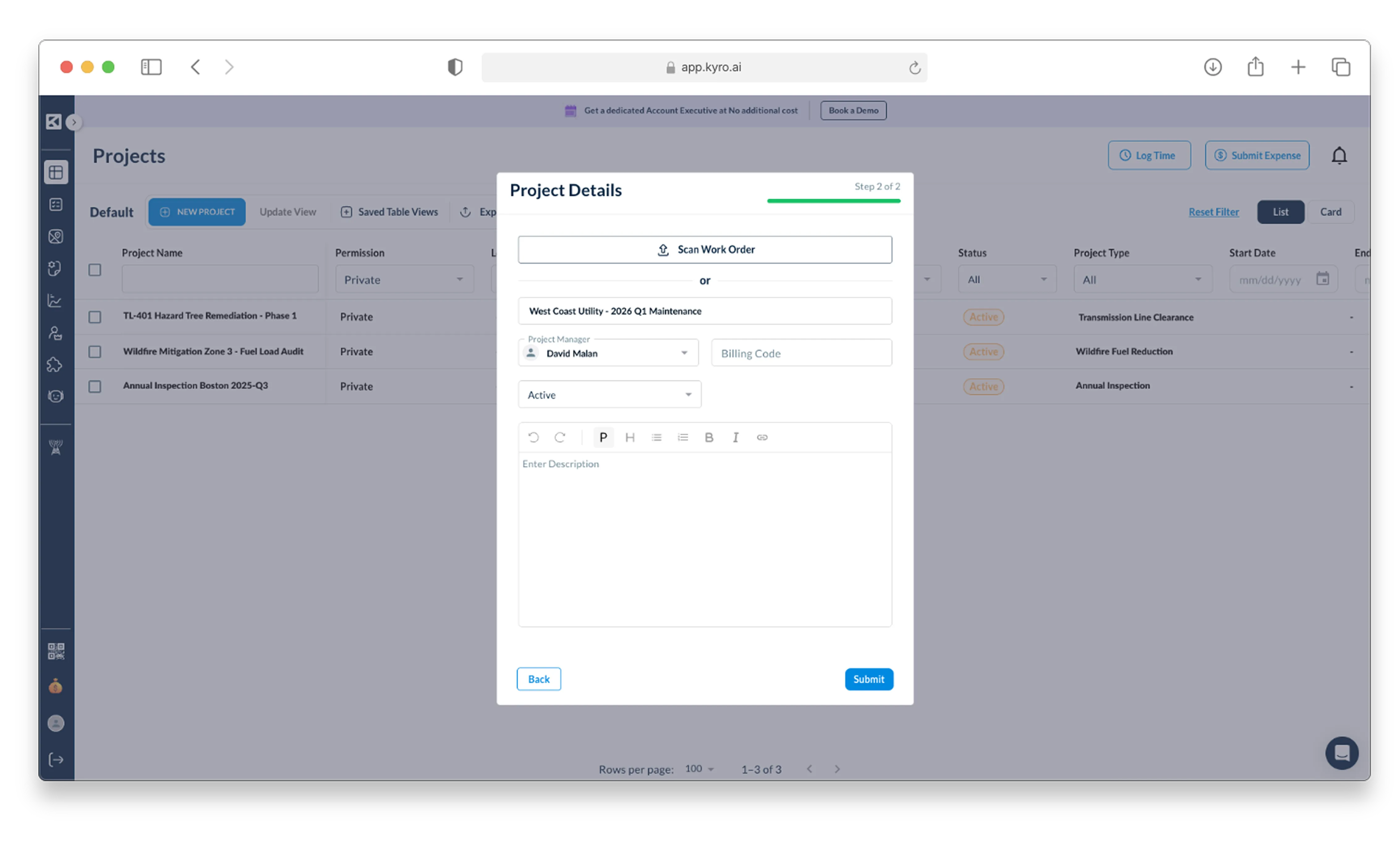
Whether it’s routine maintenance or an emergency response, set up projects in minutes. Define priority zones, clearance goals, and crew assignments to get teams moving fast.
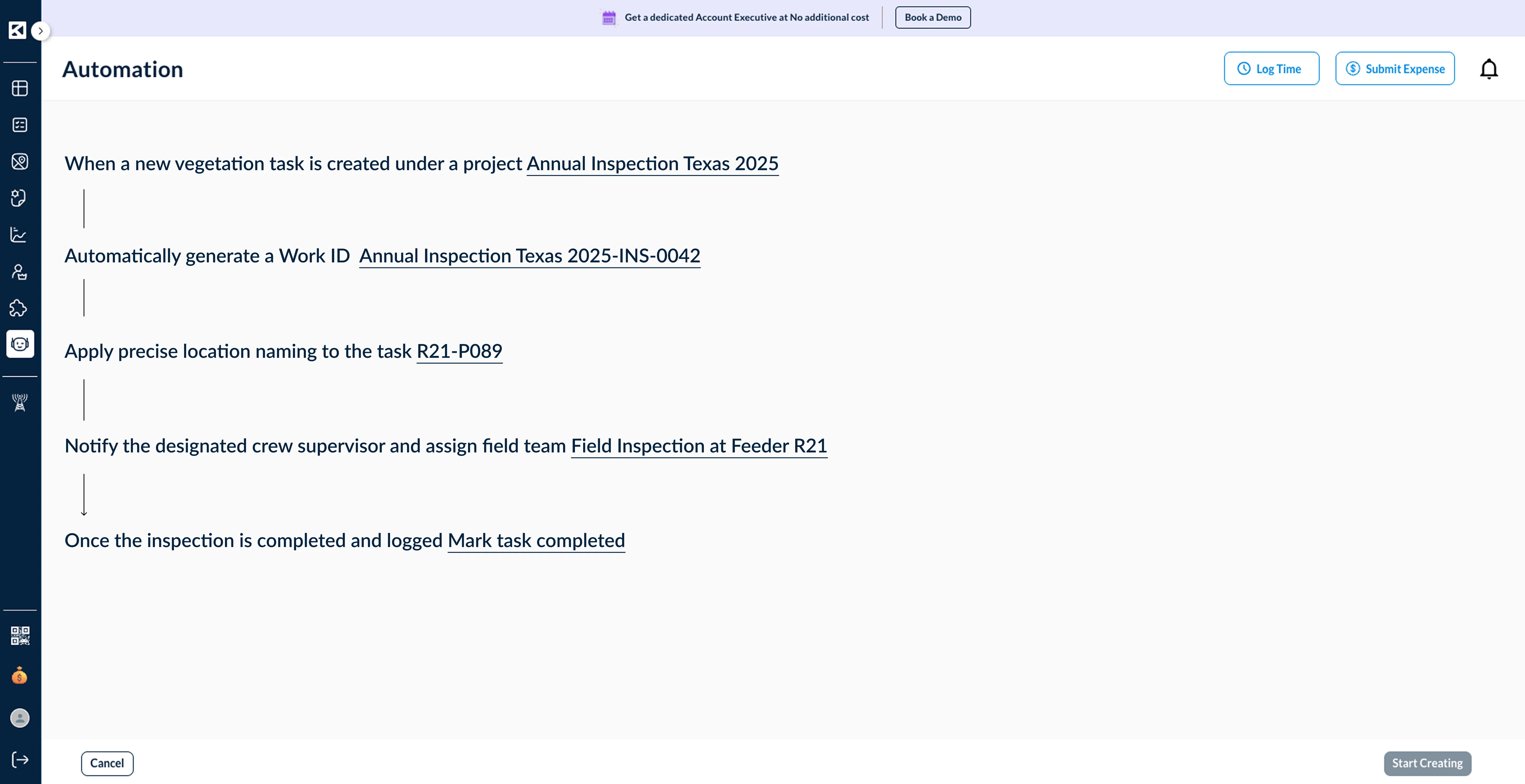
Create workflows that match your specific vegetation goals. Whether it’s trimming near powerlines, clearing rights-of-way, or inspecting structures, every task follows the right sequence with zero guesswork.
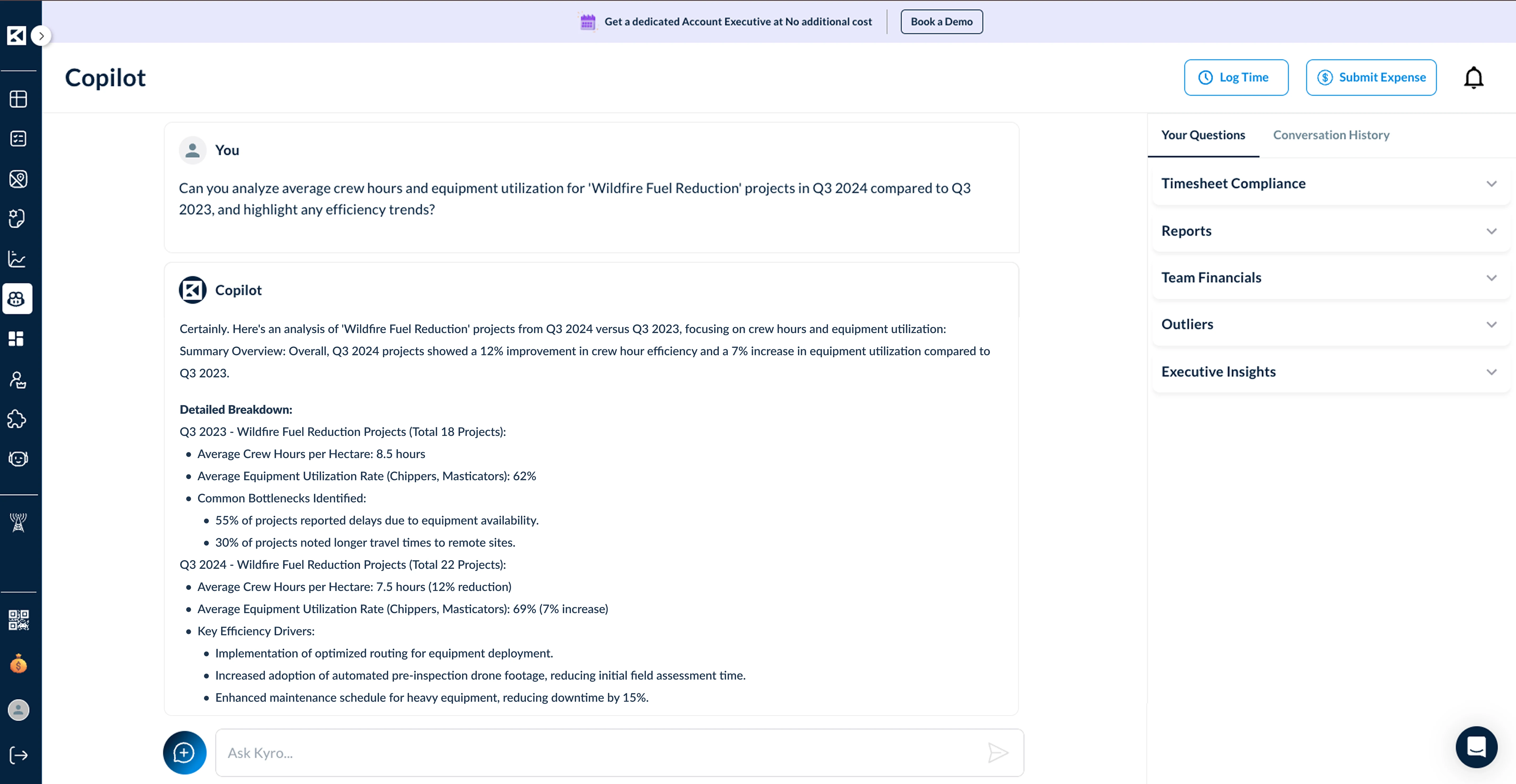
Use past data to forecast vegetation growth patterns, equipment needs, and crew hours. Plan treatments, allocate budgets, and control costs before the work begins.
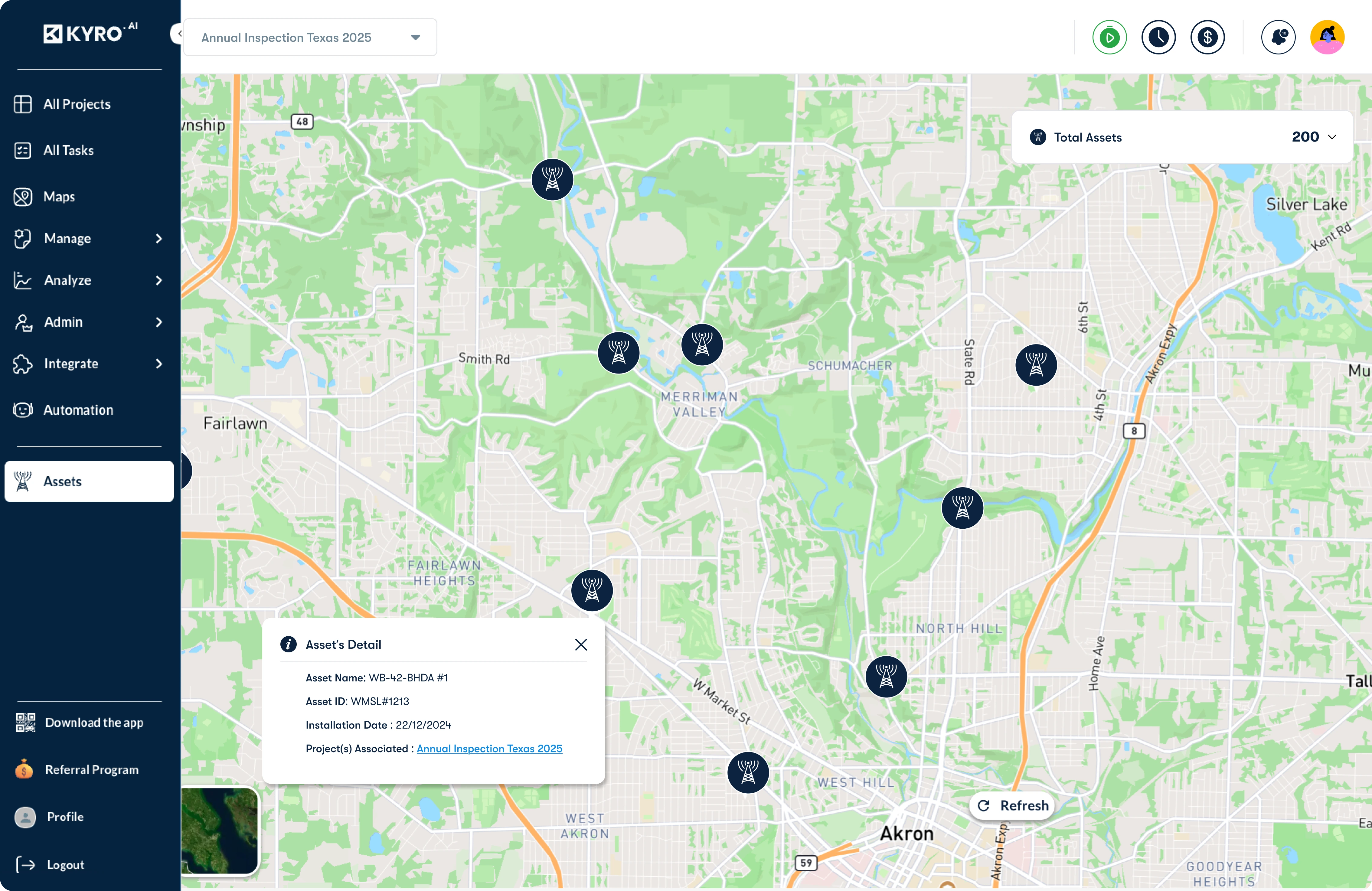
Access high-precision maps that pinpoint structures, vegetation density, and risk zones—so crews know exactly where to focus, reducing time in the field and improving treatment accuracy.