Keeping vegetation in check around power lines, pipelines, and railways isn't just about maintenance—it's about safety, compliance, and preventing costly disasters like wildfires and outages. In 2026, the stakes have never been higher.
With new FERC vegetation management standards taking effect, stricter state-level wildfire mitigation requirements, and increasing grid modernization mandates, choosing the right Utility Vegetation Management (UVM) software is more critical than ever.
Utilities allocate between $6 billion and $8 billion annually to managing vegetation around overhead power lines. California alone spends $1 billion on wildfire prevention, with similar investments accelerating across fire-prone states.
What's changed in 2026?
The UVM software landscape has evolved significantly:
AI-powered predictive analytics now forecast vegetation risks 6-12 months in advance
Integrated drone and satellite monitoring provide real-time, comprehensive coverage
Climate risk modeling helps utilities prepare for changing weather patterns
Enhanced mobile capabilities enable true offline field work
This comprehensive comparison guide evaluates the 10 best utility vegetation management software solutions available in 2026, helping you find the perfect fit for your organization's size, budget, and specific challenges.
How We Evaluated These Utility Vegetation Management Solutions
To provide you with the most accurate and useful comparison, we evaluated each UVM software solution based on seven critical criteria:
How well does the software forecast vegetation growth, identify risk patterns, and predict potential failures before they occur?
Does it seamlessly integrate with existing GIS systems? How precise is the vegetation mapping and spatial analysis?
Best Overall: KYRO AI ($21/user/month) – AI-powered risk assessment, real-time data, project level dashboards, & comprehensive compliance tracking
Best for GIS Mapping: Trimble Vegetation Manager (Custom pricing) – Advanced drone & satellite imagery with LiDAR integration
Best for Predictive Analytics: AiDash (Custom pricing) – Satellite-powered AI for real-time monitoring & 12-month forecasting
Best for Work Order Automation: Clearion (Custom pricing) – GIS-integrated work order & compliance management
Best Budget Option: SingleOps ($220/user/month) – Affordable field service management with scheduling & invoicing
Best for Satellite Monitoring: LiveEO (Custom pricing) – Remote AI-driven vegetation detection
Best for Enterprise Utilities: ArcGIS Utility Network (Custom pricing) – Advanced geospatial analytics & infrastructure planning
Best for Precision Analysis: Cyient CyVAR (Custom pricing) – LiDAR-based vegetation modeling
Detailed Vegetation Management Software Reviews
1. KYRO
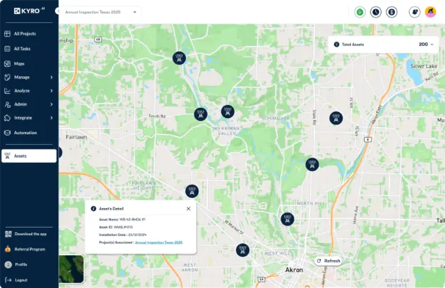
KYRO AI Vegetation Management Software solution
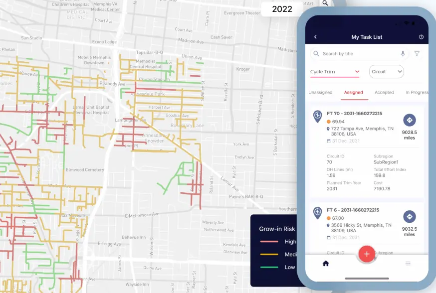
KYRO AI is built for how electric utilities operate in 2026. Long corridors, tight regulations, storm pressure, and zero room for guesswork. Instead of reacting after issues show up, KYRO uses AI and live field data to help teams spot vegetation risks early, while there’s still time to act.
For utilities focused on protecting the grid, reducing outages, and keeping up with evolving compliance requirements, KYRO AI becomes a system of record. Crews can track time, document field activity, and capture inspection data as work happens, giving operations and compliance teams a clear picture of what’s really going on in the field.
Where KYRO AI proves its value is in high-risk regions, Utilities across different regions have used the platform to stay ahead of stricter wildfire mitigation rules. With better visibility into vegetation conditions, and end-to-end digitization of inspection history and crew activity, KYRO AI helps eliminate paperwork or manual reporting.
KYRO AI works across web, mobile, and aerial inspections, so teams aren’t tied to a desk or dependent on connectivity in remote areas.
What’s New in 2026
KYRO AI has got an improved offline mobile performance for remote utility corridors with simple and effective workflows. The platform now supports scheduled vegetation treatments and has automated workflows, helping utilities plan, track, and execute vegetation management work with greater control and consistency across their service territories.
Key Capabilities
Real-time safety monitoring and overgrowth risk analysis to catch issues before they escalate
Custom annual/ ground inspection forms and checklists tailored to vegetation management work
Reliable offline functionality for remote and storm-affected areas
Cuts audit prep time with structured, ready-to-export compliance reports
❌ Cons:
Pricing may be a stretch for smaller municipal utilities
Advanced features might take some time to fully roll into daily workflows
Some older systems may need custom integration work
Our Verdict
KYRO AI is best suited for mid-to-large electric utilities and contractors managing large territories and high-risk environments. While it’s positioned at a premium, most teams see payback through fewer outages, tighter compliance control, and better coordination between the field and the office.
Pricing
Free trials are available. Custom enterprise pricing is available based on utility size and operational needs.
Best For
Large electric utilities and contractors overseeing vegetation inspection and compliance across wide service areas. Best suitable as an end-to-end arborist vegetation management software.
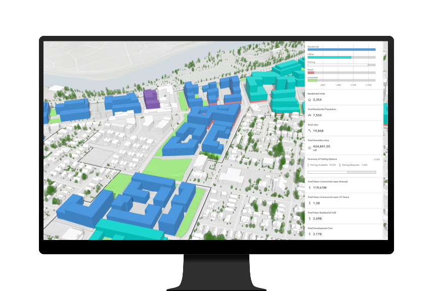
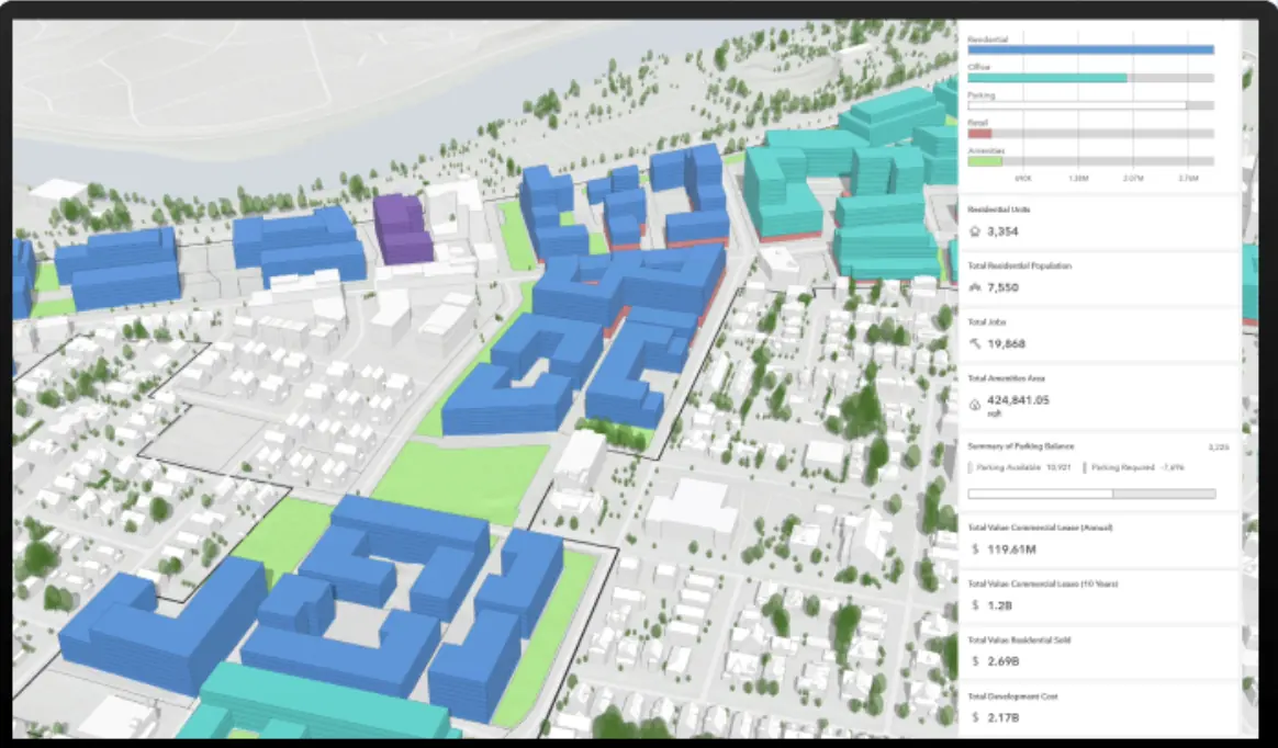
ArcGIS Utility Network by Esri is built for utilities that rely on geospatial accuracy to manage vegetation risk and complex infrastructure at scale. It gives teams a detailed, location-based view of how vegetation interacts with the grid, helping planners and operations teams see encroachments, assess risk, and plan maintenance with precision.
For utilities that depend on high-resolution mapping and deep integration with enterprise systems, ArcGIS Utility Network has become the benchmark. It’s less about quick field data capture and more about long-term network modeling, planning, and system-wide visibility across large service territories.
Key Capabilities
Advanced spatial analytics to identify vegetation encroachments near energized lines
Integration with satellite, aerial, and drone imagery for ongoing vegetation monitoring
Predictive modeling to anticipate vegetation-related outages and risks
Connectivity with OMS, EAM, and asset management platforms
Network tracing tools to analyze downstream impacts of vegetation issues
3D visualization to assess vegetation proximity to infrastructure
Historical data analysis to track growth patterns and recurring problem areas
✅ Pros:
Industry-leading GIS and spatial analysis capabilities
Deep integration across the Esri ecosystem
Strong fit for utilities already standardized on ArcGIS
Scales well across large, geographically complex networks
Powerful visualization and reporting for planners and engineers
❌ Cons:
Requires GIS expertise to use effectively
Higher cost due to licensing and training requirements
Can be more complex than necessary for smaller utilities
Often needs dedicated GIS staff to manage and maintain
Our Verdict
ArcGIS Utility Network is best suited for large, enterprise utilities with mature GIS programs and the resources to support advanced spatial analysis. It’s especially valuable for utilities managing wide, diverse territories where long-term planning and network modeling are critical. Utilities new to GIS or with simpler operational needs may find the system heavy and costly to adopt.
Pricing
Custom pricing based on organization size, licensing structure, and selected modules. Expect a significant investment, particularly for enterprise deployments.
Best For
Enterprise electric utilities, infrastructure planning teams, and organizations with established GIS operations.
3. Trimble Vegetation Manager
via Trimble
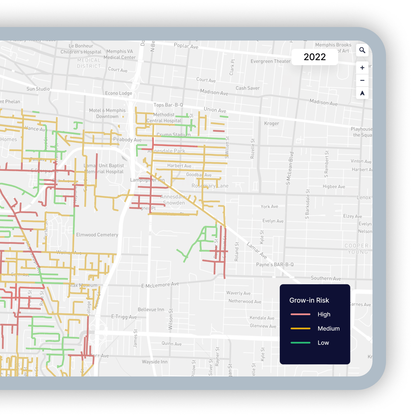
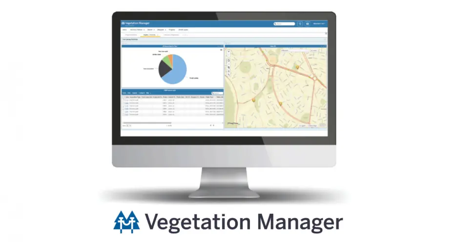
Trimble Vegetation Manager is a cutting-edge utility vegetation management software designed to help electric utilities monitor vegetation, optimize maintenance, and reduce the risk of power outages. By leveraging AI-driven analytics, remote sensing, and GIS mapping, it provides precise data for proactive vegetation control, making it a go-to tool for field teams and utility managers.
Key Features:
Advanced remote sensing using satellite, drone, and LiDAR technology for accurate vegetation monitoring
Predicts tree growth and potential power line interference with seasonal models
Streamlines scheduling and dispatching for vegetation crews
GIS integration with real-time mapping and risk visualization
Mobile data collection with offline synchronization
Vegetation height and clearance calculations
Historical imagery comparison for growth trend analysis
Best-in-class LiDAR processing and analysis capabilities
Excellent drone imagery integration with multiple UAV platforms
Strong mobile app for field data collection and crew coordination
Comprehensive vegetation growth modeling
Good balance of advanced features and usability
❌ Cons:
Requires investment in drone or LiDAR data acquisition
Custom pricing can be difficult to budget without detailed quote
Some features overlap with other Trimble utility products
Integration with non-Trimble systems may require additional work
Our Verdict:
Trimble Vegetation Manager excels only for utilities that prioritize remote sensing and want to leverage drone or LiDAR technology. It's particularly strong for transmission line vegetation management where precision clearance measurements are critical. The investment makes most sense for utilities already using Trimble products or planning significant drone/LiDAR deployment.
Pricing:
Custom pricing based on utility size, data volumes, and feature needs. Typically includes per-mile or per-circuit pricing models.
Best For:
Vegetation management teams focused on remote sensing and precision measurements
AiDash is an AI-powered satellite-based vegetation management solution that helps utilities proactively monitor and mitigate vegetation risks. By combining real-time satellite imagery, predictive analytics, and machine learning, AiDash enables utilities to reduce outages, enhance compliance, and optimize maintenance schedules.
Key Features:
Satellite-powered vegetation monitoring to assess vegetation risks across entire service territory
AI-driven predictive analytics to forecast tree growth and potential power line interference up to 12 months ahead
Anomaly detection & early warnings to identify risks before they escalate
Centralized operations dashboard for streamlined decision-making
Automated compliance reporting for regulatory requirements
Wildfire risk scoring and mitigation planning
Storm damage assessment and post-event analysis
Integration with utility GIS and work management systems
✅ Pros:
Comprehensive satellite coverage eliminates need for manual inspections
Excellent predictive accuracy for vegetation growth forecasting
Rapid deployment without field equipment requirements
Cost-effective for monitoring large service territories
Strong wildfire risk assessment capabilities increasingly important now
❌ Cons:
Satellite resolution may not capture all ground-level details
Weather conditions can affect image quality and update frequency
Less hands-on field data compared to drone-based solutions
Requires stable internet for dashboard access
Our Verdict:
AiDash is the top choice for utilities that need to monitor vast service territories cost-effectively and want industry-leading predictive analytics. It's particularly valuable for utilities in wildfire-prone regions or those managing long transmission corridors. The satellite-based approach means less field inspection time, though some utilities supplement it with targeted drone missions for high-risk areas.
Pricing:
Custom pricing based on utility size, service territory square mileage, and feature requirements. Subscription-based annual contracts.
Best For:
Electric utilities and energy providers requiring satellite-based vegetation monitoring with AI-powered insights, especially those in wildfire-prone regions
5. Cyient
Cyient offers CyVAR (Cyient Vegetation Analysis and Reporting), a powerful solution for managing vegetation in the transmission and distribution (T&D) sector. It provides high-precision vegetation analysis through LiDAR data, AI-driven risk assessment, and GIS integration. Designed for electric utilities, its advanced analytics and predictive modeling help prevent power outages and ensure regulatory compliance.
Key Features:
LiDAR & drone-based vegetation mapping for precise monitoring down to centimeter-level accuracy
AI-powered risk forecasting to identify vegetation encroachment trends
GIS & compliance integration to ensure utilities meet NERC FAC-003-4, OSHA, and state standards
Dynamic vegetation growth simulations to predict long-term risk trends
Automated clearance calculations and violation detection
Multi-year vegetation management planning and budgeting tools
Species-specific growth rate modeling
Integration with SAP and other utility EAM systems
✅ Pros:
Exceptional precision from LiDAR data processing expertise
Comprehensive analytics and reporting capabilities
Strong consulting support for implementation and optimization
Excellent for transmission line clearance analysis
Flexible deployment options (cloud or on-premise)
❌ Cons:
Requires high-quality LiDAR data acquisition (additional cost)
Complexity may require dedicated analyst resources
Custom pricing makes budgeting challenging
Best suited for larger utilities with technical resources
Our Verdict:
Cyient CyVAR is the premium choice for utilities that demand the highest precision vegetation analysis and have transmission clearance as a critical priority. The LiDAR-based approach provides unmatched accuracy, making it ideal for utilities facing strict regulatory requirements or operating in challenging terrain. However, mid-sized utilities looking for immediate results may find investment and technical requirements beyond their needs.
Pricing:
Custom pricing based on utility needs, data volumes, and consulting services required. Typically structured as annual licensing plus professional services.
Best For:
Utilities needing high-precision vegetation analysis with LiDAR and AI-powered forecasting, particularly for transmission line management
6. Clearion Software
Clearion Software is a work order and vegetation management platform that helps utilities and contractors streamline vegetation inspections, crew assignments, and compliance reporting. It's particularly strong for organizations that prioritize operational workflow automation.
Key Features:
Work order automation to manage vegetation maintenance tasks and field crew schedules
GIS-based vegetation tracking for real-time mapping
Compliance & reporting tools to automate regulatory documentation
Mobile field access that enables field teams to update work orders remotely
Crew time tracking and labor cost management
Equipment and materials inventory management
Customer notification and communication tools
Integration with utility billing and asset management systems
✅ Pros:
Excellent work order management and crew coordination
User-friendly interface requires minimal training
Strong mobile app functionality for field operations
Good value for utilities focused on operational efficiency
Responsive customer support
❌ Cons:
Less advanced AI and predictive analytics compared to KYRO AI or AiDash
GIS capabilities not as sophisticated as Trimble or ArcGIS
Limited satellite or drone imagery integration
May need supplementation for comprehensive vegetation risk assessment
Our Verdict:
Clearion is best suited for utilities and vegetation contractors that prioritize work order automation and crew management over advanced analytics. It's an excellent choice for organizations that already have vegetation assessment tools but need better operational workflows. The focus on practical field operations makes it particularly valuable for distribution-focused utilities.
Pricing:
Custom pricing based on business size, number of users, and feature requirements. Typically includes implementation and training.
Best For:
Utilities and contractors looking for end-to-end work order management with GIS-based tracking, especially distribution-focused operations
7. Vegetation Management Suite by ACRT Services
ACRT Services offers a specialized vegetation management suite tailored for electric utilities and infrastructure companies. It enhances risk mitigation, regulatory compliance, and operational efficiency with a consulting-backed approach that combines software with industry expertise.
Key Features:
Field data collection to capture vegetation growth patterns in real time with specialized forms
Risk management for power line clearances with standardized methodologies
Custom solutions for utilities with flexible, utility-specific workflows
Consulting services integrated with software deployment
Regulatory compliance tracking for ANSI A300, ISA standards
Vegetation management program design and optimization
Quality assurance and audit capabilities
Training and certification programs for field crews
✅ Pros:
Deep industry expertise from decades of vegetation management consulting
Highly customizable to specific utility needs and regional requirements
Excellent consulting support for program optimization
Strong compliance tracking and audit preparation
Good for utilities building or restructuring VM programs
❌ Cons:
May require more consulting services investment than pure software plays
Less emphasis on cutting-edge AI/ML compared to newer platforms
Custom solutions mean longer implementation timelines
Pricing can be complex with software plus services model
Our Verdict:
ACRT Services is ideal for utilities that want proven vegetation management expertise combined with technology. It's particularly valuable for organizations building new programs, restructuring existing operations, or facing complex regulatory challenges. The consulting-backed approach provides peace of mind but comes at a premium compared to software-only solutions.
Pricing:
Custom pricing based on utility needs, compliance requirements, and consulting services scope. Typically combines software licensing with professional services.
Best For:
Utilities and infrastructure firms needing custom vegetation risk management solutions with expert consulting support
8. LiveEO
LiveEO uses AI-powered satellite imagery to help utilities track vegetation growth, detect risks, and automate compliance reporting. Their fully remote monitoring approach represents the cutting edge of satellite-based vegetation management.
Key Features:
Satellite-based vegetation monitoring to reduce manual inspections across entire networks
AI-driven risk detection to identify potential threats before they cause outages
Integration with GIS systems to enhance vegetation mapping and analysis
Automated alert generation for high-risk areas requiring attention
Historical vegetation change analysis and trending
Wildfire risk assessment and tracking
Regulatory compliance reporting automation
API access for custom integrations
✅ Pros:
Completely eliminates need for many manual field inspections
Excellent for monitoring large, remote service territories
Cost-effective compared to traditional inspection methods
Rapid deployment without field equipment
Growing track record in European and US markets
❌ Cons:
No mobile field app for ground-level data collection
Satellite resolution limitations for some vegetation details
Weather-dependent image quality
May need supplementation with field verification for critical areas
Newer to North American market compared to established players
Our Verdict:
LiveEO is an excellent choice for utilities wanting to minimize field inspection costs while maintaining comprehensive vegetation monitoring. It's particularly well-suited for rural utilities with extensive service territories or those facing budget constraints. However, most utilities will want to supplement satellite monitoring with some field verification, especially for critical transmission corridors.
Pricing:
Flexible pricing based on satellite coverage area, update frequency needs, and utility size. Subscription-based annual contracts.
Best For:
Utilities seeking remote vegetation monitoring using satellite data and AI-powered risk analysis, especially those with large rural service territories
9. SingleOps
SingleOps is an all-in-one field service management platform for arborists and utility vegetation management teams, improving job tracking, scheduling, and invoicing. It's designed to be affordable and accessible for smaller operations.
Key Features:
Work order & scheduling tools to optimize crew assignments and field operations
GPS tracking & route optimization to ensure efficient fieldwork
Inventory & chemical usage tracking that manages materials for vegetation treatments
Client portal & real-time updates to keep customers informed
Estimating and proposal generation tools
Digital payment processing and invoicing
Time tracking and payroll integration
Equipment maintenance tracking
✅ Pros:
Most affordable full-featured option for small teams
Quick implementation with minimal training required
Excellent customer relationship management tools
Strong invoicing and payment processing
Good mobile app for field crews
Responsive customer support
❌ Cons:
Limited advanced analytics and predictive capabilities
Basic GIS integration compared to enterprise solutions
Not designed for large utility-scale operations
Lacks AI-powered risk assessment
Better suited for contractors than utilities
Our Verdict:
SingleOps is the best choice for small to mid-size vegetation management contractors and small municipal utilities with limited budgets. It provides solid business management tools at an affordable price point. However, large investor-owned utilities or those needing sophisticated predictive analytics should look at more advanced platforms like KYRO or AiDash.
Pricing:
Starts from $200/user per month with free trial available. Volume discounts for larger teams.
Best For:
Arborists and vegetation management contractors needing end-to-end business management tools, small municipal utilities with budget constraints
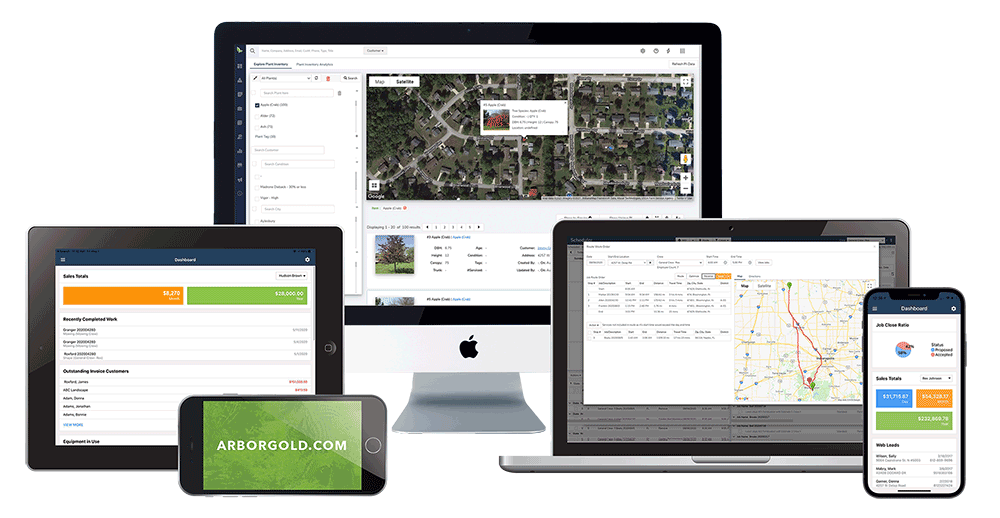
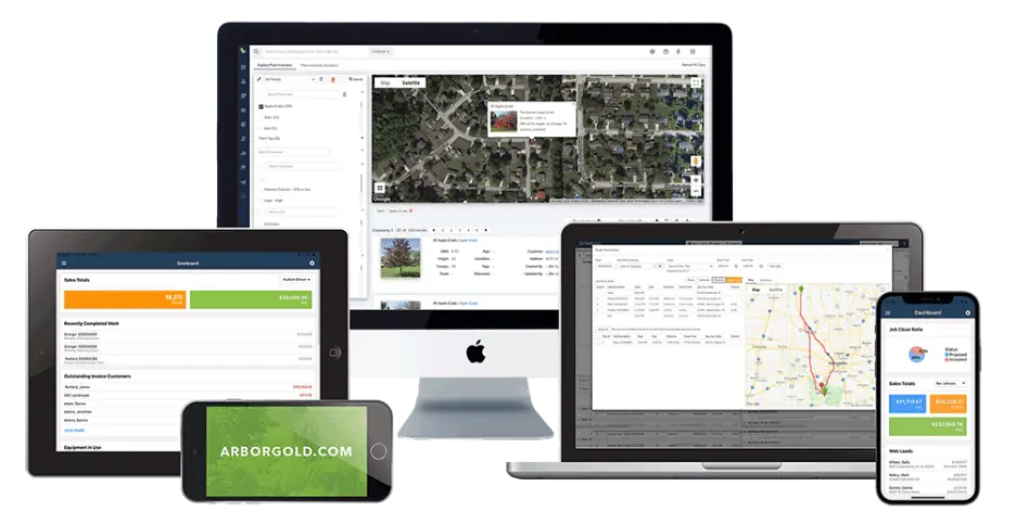
Arborgold is a comprehensive vegetation and landscape management tool that enhances scheduling, bidding, and invoicing for vegetation management businesses. It's particularly popular among tree care companies that also do utility work.
Key Features:
Flexible scheduling & job tracking to keep crews on track with real-time updates
Custom landscape design & bidding tools
Automated invoicing & payments that simplifies billing
Track conversations, work orders, and customer interactions through built-in CRM
Allows customization of quotes and milestone payments with automated invoicing options
Multi-channel support including phone, email, and knowledge base
Equipment and chemical inventory management
Employee time tracking and payroll integration
Marketing tools for business growth
✅ Pros:
Most affordable option at $129/month starting price
Comprehensive business management features beyond just vegetation management
Excellent for companies doing both commercial and utility vegetation work
Strong CRM and customer communication tools
Good reporting for business analytics
Easy to learn and implement
❌ Cons:
Minimal GIS or mapping capabilities
No AI-powered risk assessment or predictive analytics
Better suited for tree care businesses than utilities
Limited utility-specific compliance features
Basic mobile app compared to specialized utility platforms
Our Verdict:
Arborgold is perfect for small tree care companies and vegetation contractors that do utility vegetation work alongside commercial and residential services. At $129/month, it's the most budget-friendly option, though it lacks the sophisticated utility-specific features of platforms like KYRO AI or Clearion. It's best for businesses under 20 employees focused on business operations rather than advanced vegetation analytics.
Pricing:
Starts at $129/month with free trial available. Additional modules and users available at incremental cost.
Best For:
Vegetation management companies and tree care businesses looking for business automation, CRM, and invoicing tools
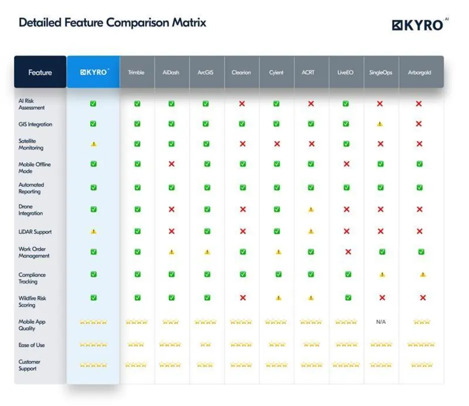
Detailed Feature Comparison Matrix for Vegetation Management Software
Feature matrix for vegetation management software - KYRO AI
Suggested read:
How do you know your vegetation management program is falling behind? Read more to know!
Conclusion: Streamline Your Vegetation Management with the Right Tools
Investing in a good utility software for vegetation management can significantly improve grid reliability, compliance, and cost-efficiency. Evaluate your needs, explore the options, and implement the best solution to keep your infrastructure safe and efficient.
KYRO AI, with its AI-driven analytics and seamless integrations, is a top choice, while other tools like ArcGIS and Trimble cater to specific needs. With these tools, utilities can ensure compliance, reduce risks, and maintain network reliability.
Want to know more on how KYRO AI can help your org get started? Talk to us today!
Author
Rabiya Farheen
Content Strategist
Rabiya Farheen is a content strategist and a writer who loves turning complex ideas into clear, meaningful stories, especially in the world of utility, tech, AI, and B2B SaaS. She works closely with growing teams to create content that doesn’t just check SEO boxes, but actually helps people understand what a product does and why it matters. With a knack for research and a curiosity that never quits, Rabiya dives deep into industry trends, customer pain points, and data to craft content that feels super helpful and informative. When she’s not writing, she’s probably reading, painting, and exploring her creative side— or you'll find her hustling around for social causes, especially those that empower girls and women.
We use cookies to understand how people use our site and to improve it. You can accept or reject them, or choose which ones we use. Read our Privacy Policy.
Cookie preferences
Choose which cookies we can use. You can change this at any time from Cookie settings in the footer.




.webp)
.webp)
.webp)